|
| |
1090 MHz informal filter tests
 |
|
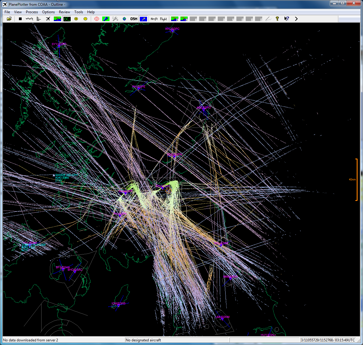
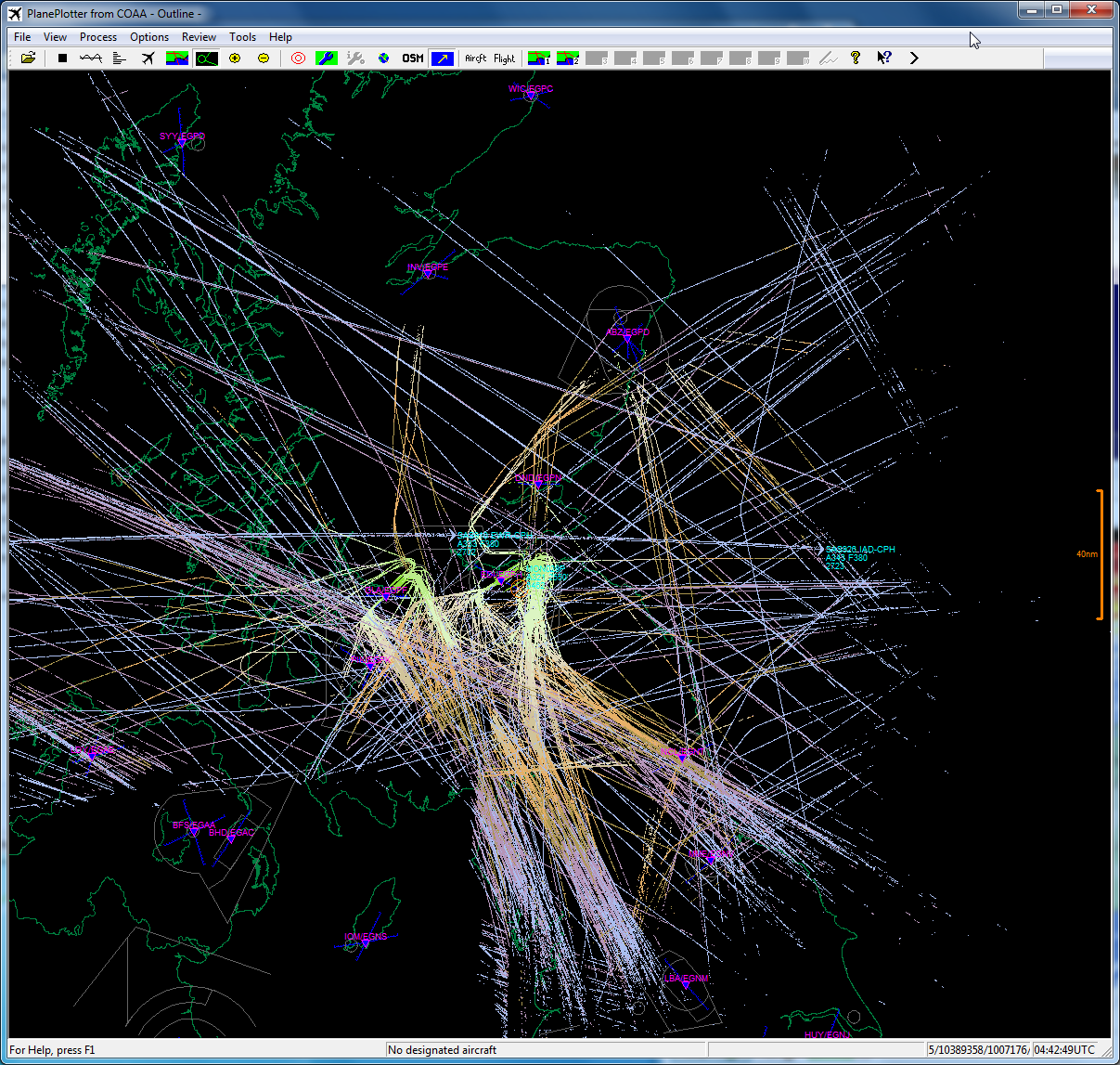
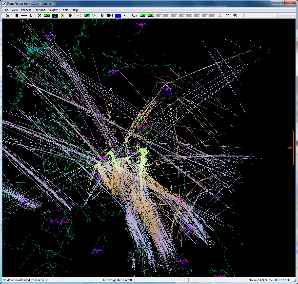
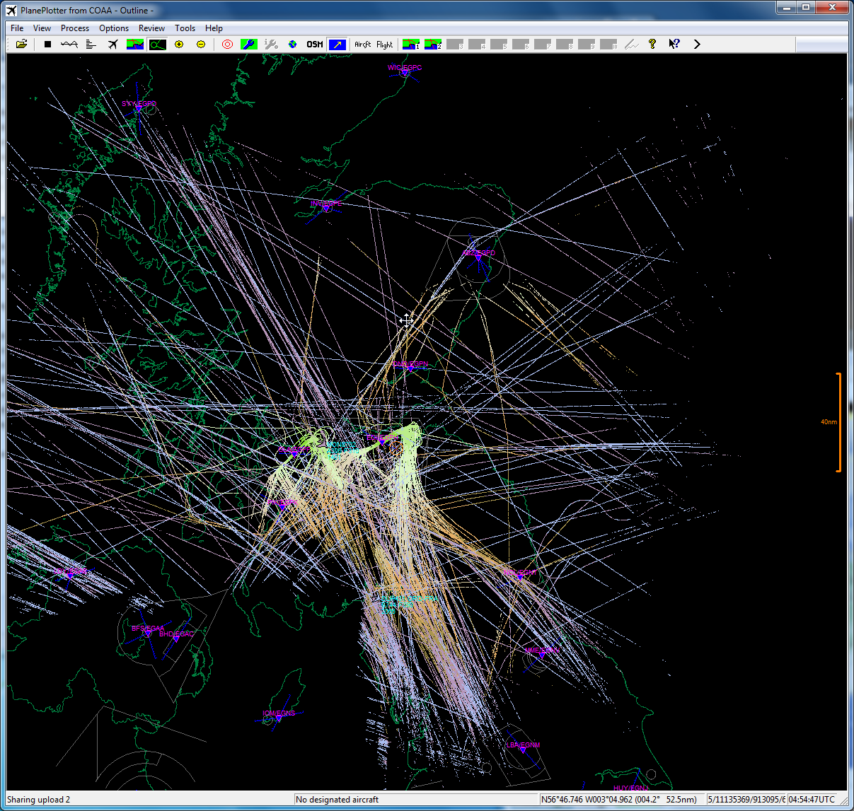
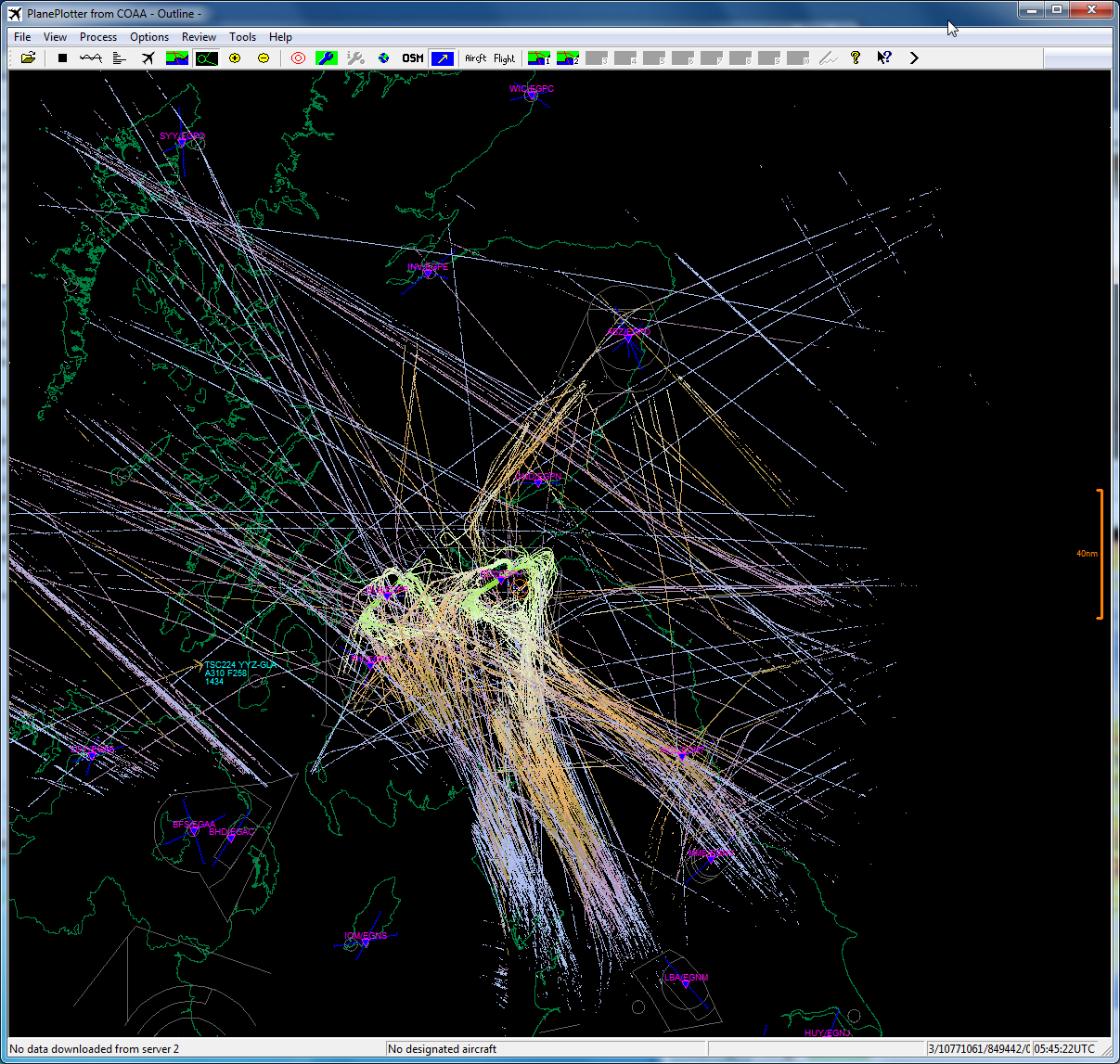
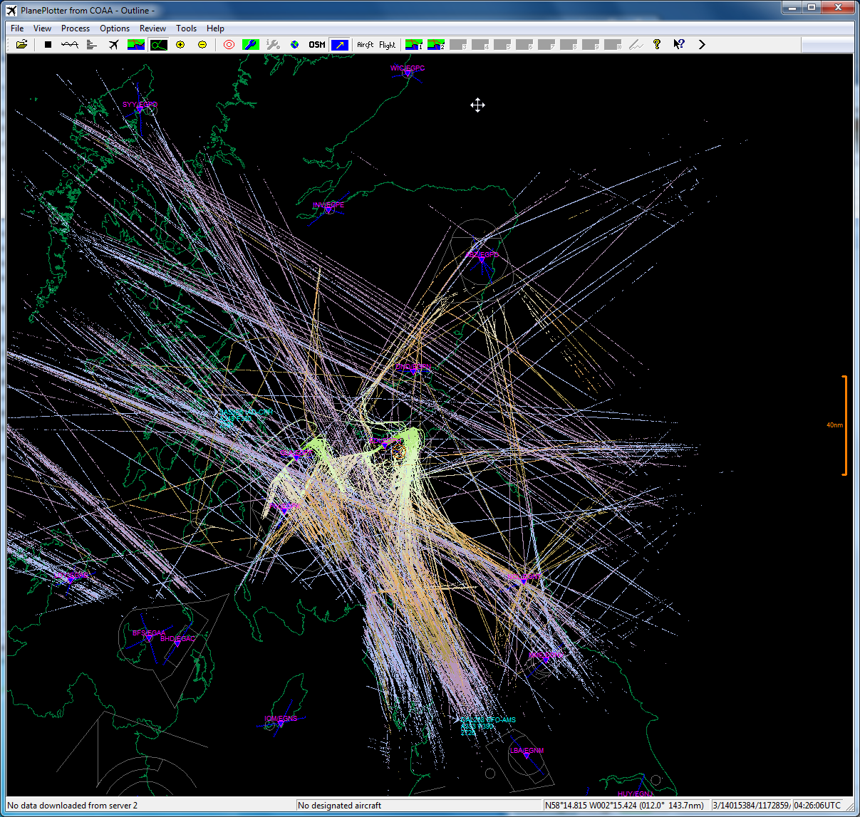
This page describes the results from informal
tests of 1.09 GHz filters on reception of ADS-B signals. The results
are from Plane Plotter, using its permanent trails feature with the
heights coloured with conventional map height coding, so green trails are
near the ground and brown/purple/pink trails up to 35,000+ feet in
altitude. What I am looking for is the extreme range, to see whether
the ~2.5 dB loss of the SAW filter is noticeable compared to the ~1 dB
loss of the cavity and interdigital filters, and how much it affects maximum range.
The data has been collected over a full weekday for each filter, to try
and compare similar traffic patterns. Of course, the actual aircraft
vary from day to day, and week to week, and summer-winter schedules, so the plots below can only be a
general indication. Look for maximum range, not the density of the
traffic. The receiver is a Mode-S
Beast,
and the antenna a Moonraker
6.5 dBd gain collinear. |
SAW filter - AS
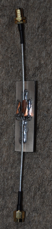
TA0970/TA1090EC-class
SAW from Golledge
|
|
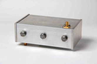
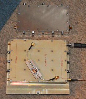
Multi-cavity filter A1 - re-tuned surplus filter
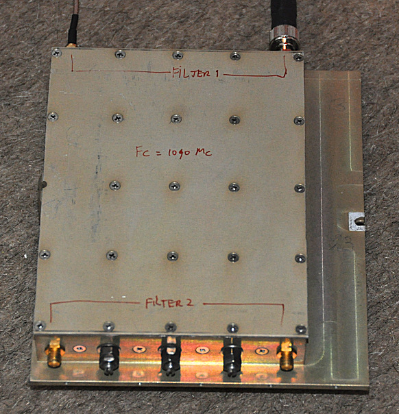
Interdigital filter B - supplied by Bert
Modderman, PE1RKI
|
Please note that due to gaps in the data collection some images are not present! Should you wish to use the same flight
levels and colours as I did, download this
text file, rename it to .REG (i.e. remove the .TXT extension), and run it
for your Plane Plotter by double-clicking. Save your own registry
settings for Plane Plotter first in case you wish to revert!
Saturday
Sunday
Monday
Tuesday
Wednesday
Thursday
Friday
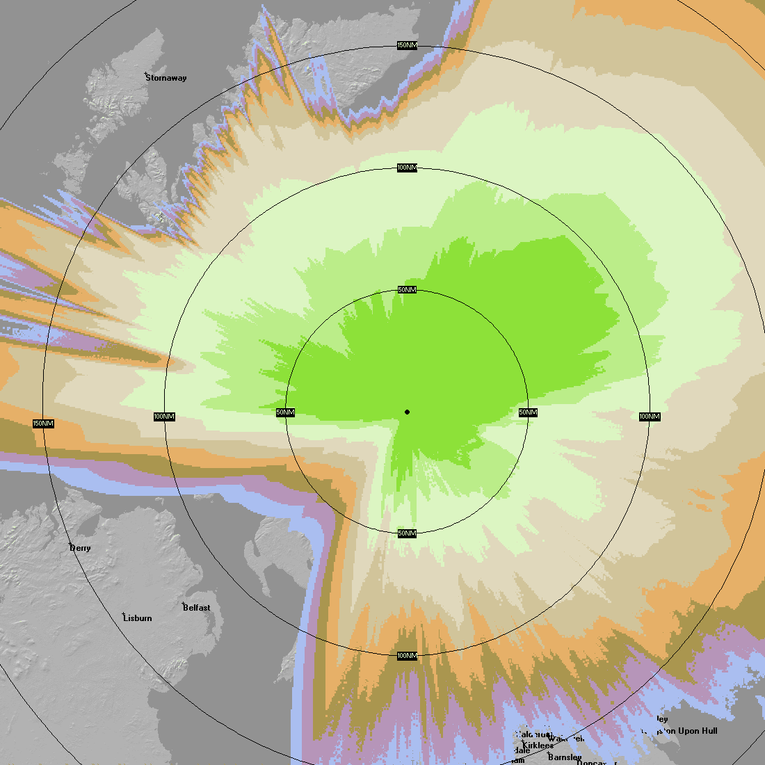
The plot below shows the predicted coverage from my location with aircraft
heights of 2500 ft up to 40000 ft FL 400).
The prediction
program I'm using is Radio Mobile
Deluxe, and it allows heights of up to 99999 m. It's difficult
to compare the plot below with the permanent trail plots above - consider this just for
fun. It's my first time of using that program, so I may easily have made
mistakes! The key parameters I used were:
Network parameters: 1090 MHz, mode mobile, 50%
Base location, RX only, elevation 169.8 m (lower than the GPS here said...).
RX threshold -90 dBm, line loss 1 dB, antenna gain 6.5 dBd, height 6 m AGL.
Aircraft, on the move, TX only, elevation 0m + variable.
TX power 100 W, line loss 1 dB, antenna gain 2.85 dBd,
Network, membership, antenna heights: 762, 1524 3048, 4572, 6096, 7620, 9144,
10688 & 12192 m
and I would be delighted to accept advice if these are wrong.
Colour |
|
|
|
|
|
|
|
|
|
Height |
2500 ft |
5000 ft |
FL 100 |
FL 150 |
FL 200 |
FL 250 |
FL 300 |
FL 350 |
FL 400 |
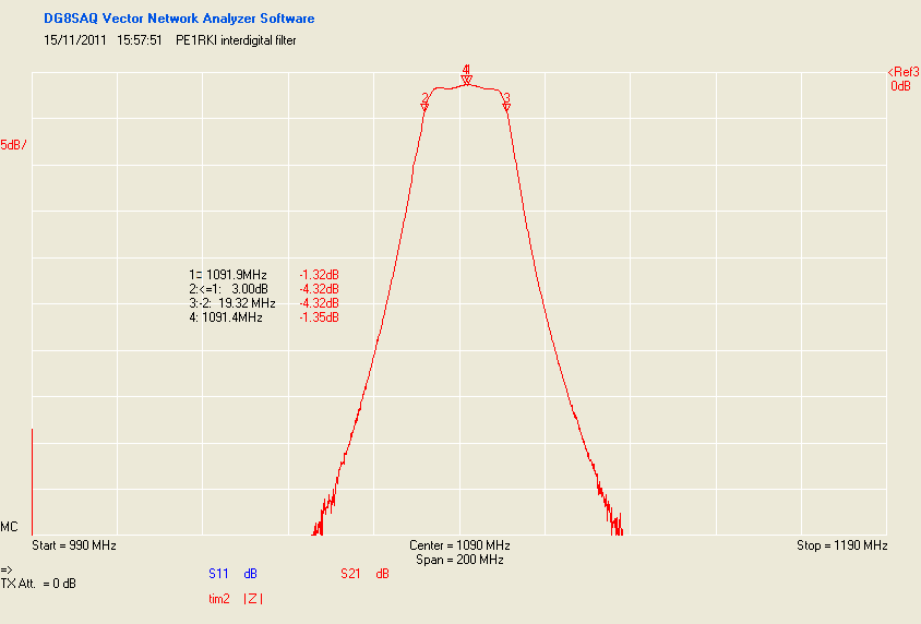
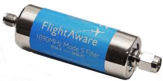
I recently bought two commercial filters for 1090 MHz ADS-B. Many people
have found that reception is enhanced with a filter, and the reason is that the
receivers typically have a very wide frequency response, and local smartphone (cellphone)
transmitters and even TV transmitters operating in the upper part of the UHF
band can desensitise your receiver making it less sensitive to ADS-B
signals. Here are the two filters I bought:
The Jetvision unit is considerably more expensive than the FlightAware unit,
so is that price difference reflected in a performance difference? I
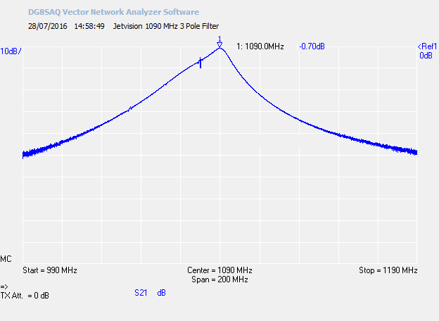
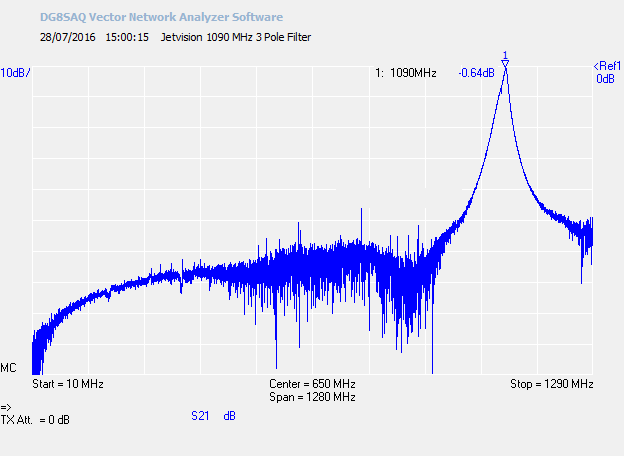
measured the response of both units, both near the mode-S frequency and over a
broader range:
Narrowband response
Broadband response
You can see that Jetvision filter had a lower loss in the passband (0.7 dB
versus 1.5 dB) and a much narrower response. At -30 dB the Jetvision
filter passed a much narrower range of frequencies (approximately 1040-1120 MHz)
compared to the 890-1240 MHz passed by the FlightAware unit. The lower
loss would provide slightly greater ultimate range, and the narrower passband
greater rejection of interfering signals. UK phone signals are in the
range up to 960 MHz, so if you are unfortunate you might find that the
FlightAware filter is not quite good enough.
I should also add that I had to send my FlightAware filter back to Amazon as
the output connection (SMA male) would only fit onto one SMA connector here, so
if you see a 30 dB loss after installing the filter perhaps this has happened to
you as well! I don't know whether this was a one-off occurrence or typical
of these devices. I hope it was one-off, but Amazon have only offered a
refund and not a replacement.
Data measured with a DG8SAQ Vector Network Analyser
- a very nice piece of kit!
|