


|
|
|
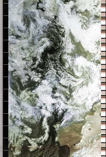
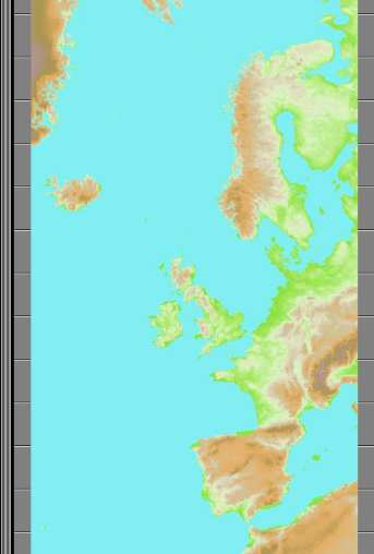
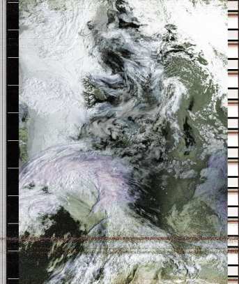
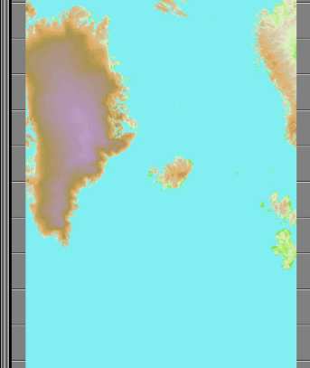
This page shows some results observed by polar orbiting satellites from the 1999 Total Solar Eclipse. As opposed to geostationary satellites, which can continuously image an area of the earth, polar orbiting satellites simply image the part of the earth over which they are travelling at any particular time. Thus it is only by chance that any image of the moon's shadow may be obtained. In the case of the 1999 eclipse, a Russian satellite got a very good view of the shadow (from Peter Henne), but I can't receive that satellite very well. I have also written up our visit to Munich to see the eclipse. The image I got was from an American satellite called NOAA-15, which has a variety of sensors including a visible and infra-red scanning radiometer. Because of the orbit, images are about 1 hour 40 minutes apart, and move westwards over the course of the day. On the 11th, I got two images, one well before any eclipse, and one where the edge of the moon's shadow was just on the extreme eastern edge of the image. I process these images to false colour with my SatSignal program, by making the thermal information from the infra-red channel control the colouring on top of the black-and-white visible channel. You will notice that in the later image, not only is the shadow visible, but the cloud tops are a purple colour indicating that they are very cold. Note that the same area on the earlier picture does not indicate such cold clouds. I presume this coldness may be related to lack of solar radiation. However, I have not examined this in greater detail, and would like to co-operate and perhaps obtain better quality images (possibly HRPT) than I can get with my simple equipment. As there is considerable cloud, and as the later image is mainly over the Atlantic ocean, I have also included some predicted ground track images from my WXtrack program to enable you to orient yourself more easily. The images are one third the size of the original, both to reduce the download time, and because I am only trying to indicate some general effect rather than claiming a pin-point shadow effect from the region of totality. You can find out more about weather satellites on this Web site.
| ||||||||||||
|
|