


|
|
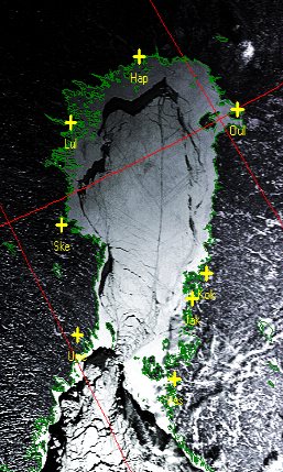
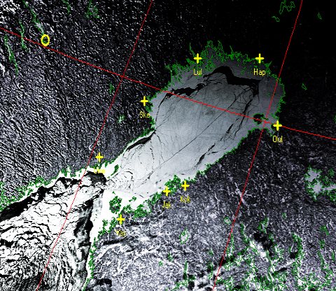
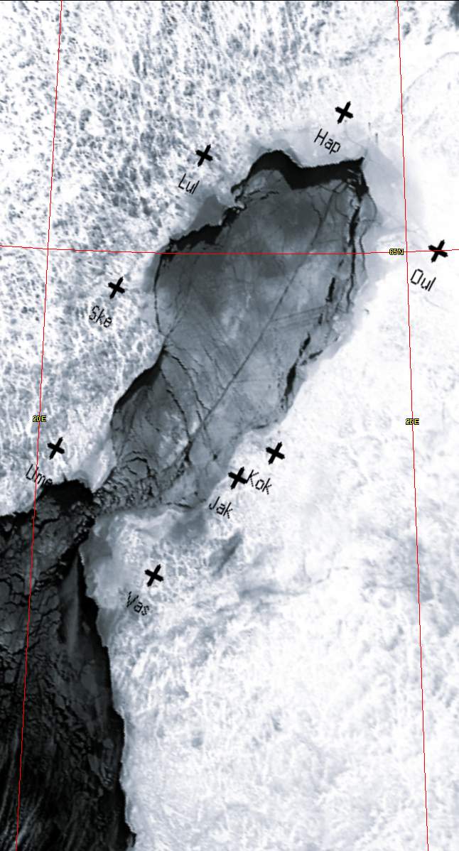
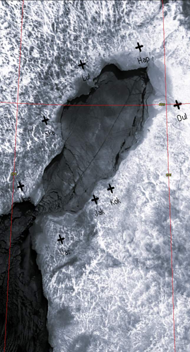
Icebreaker tracksAre these Icebreaker tracks? Arne van Belle recently suggested that these lines in the Baltic Sea were formed by Icebreaker activity - they certainly seem very straight. What do you think? Comments on the GEO Subscribers self-help group if possible. The images were from the NOAA-16 and NOAA-17 polar orbiting satellites, taken on January 10 2003 and processed with my HRPT Reader. In the false-colour visible channel images, the shading towards the top of the image is because of the low light level in these northern regions in mid-winter. I have also included two thermal channel images at the bottom of the page which have been rectified to a common polar stereographic projection using my GroundMap program. These do show the detail more clearly than the visible images. Differences between the two thermal images are purely how I happened to choose the gains when processing.
| ||||||||
|
|